iOS 17 · Free to start
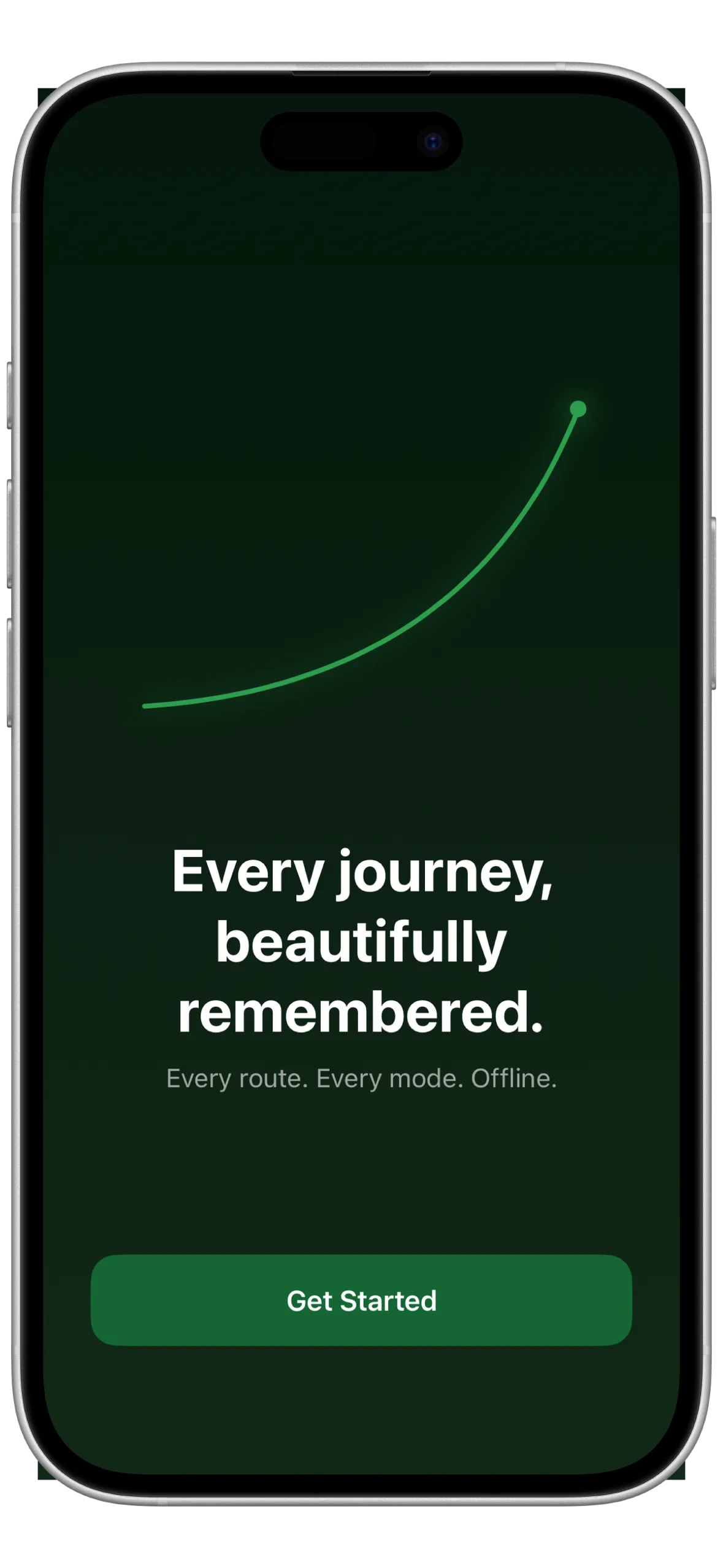
Every journey, perfectly saved.
Skylog logs every walk, ride, flight, and drive. Beautiful GPS records that stay with you forever.
Download on the
App Store
Free · iOS 17+
Skylog logs every walk, ride, flight, and drive. Beautiful GPS records that stay with you forever.
Why Skylog
Tap once and walk away. Skylog records your precise route in the background, even when your screen is off or you switch apps.
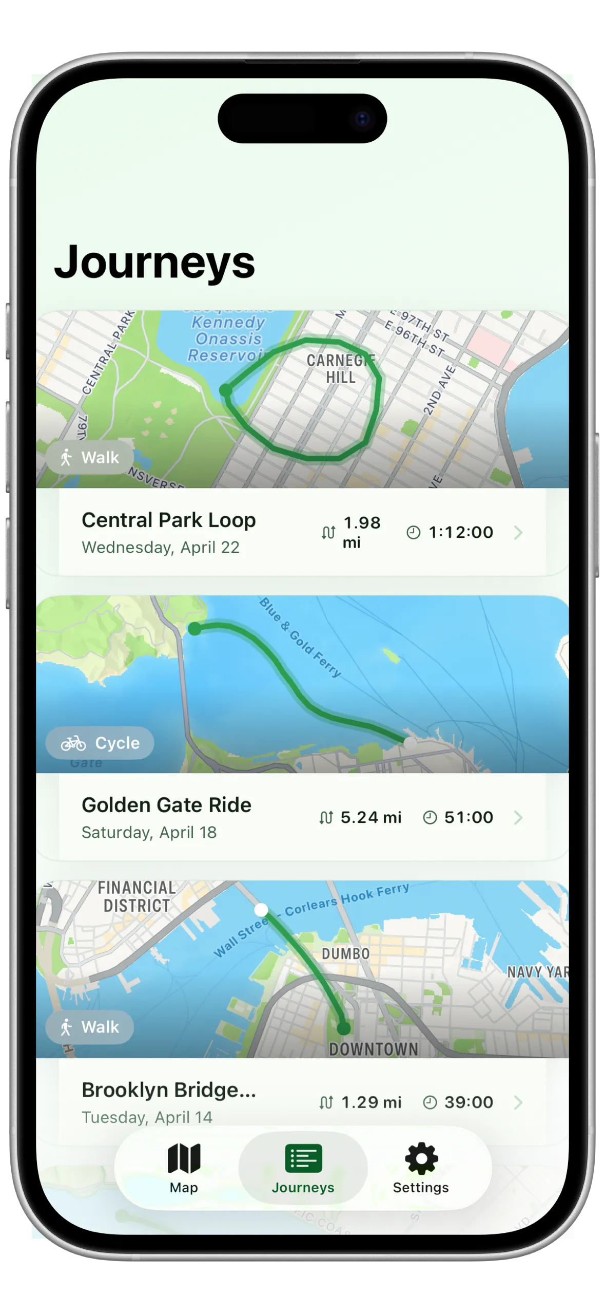
Every trip saved as a beautiful card with a route map thumbnail, distance, duration, and travel mode. Swipe to delete anything you don't want.
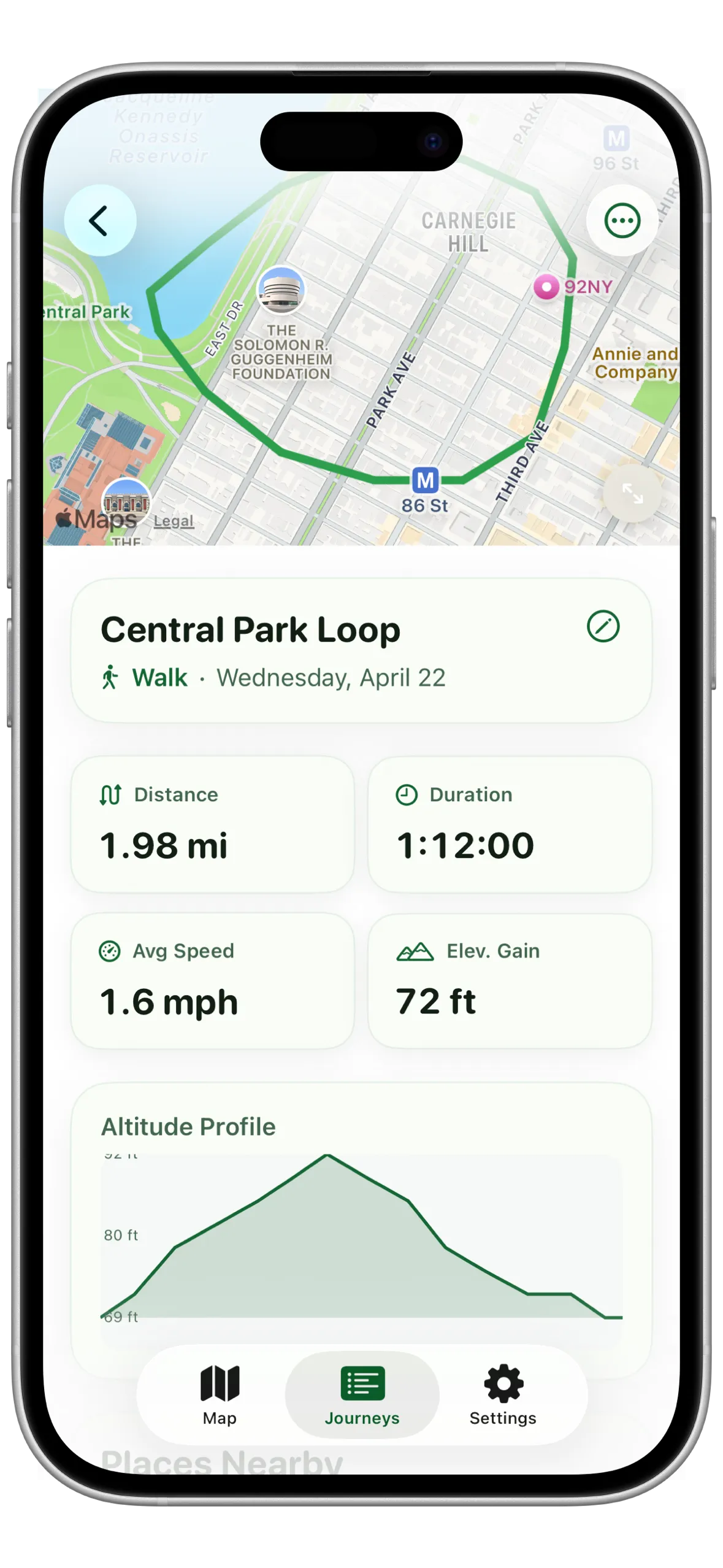
Distance, duration, average speed, and elevation gain on every journey. Plus a full altitude profile chart so you can see every hill and descent.
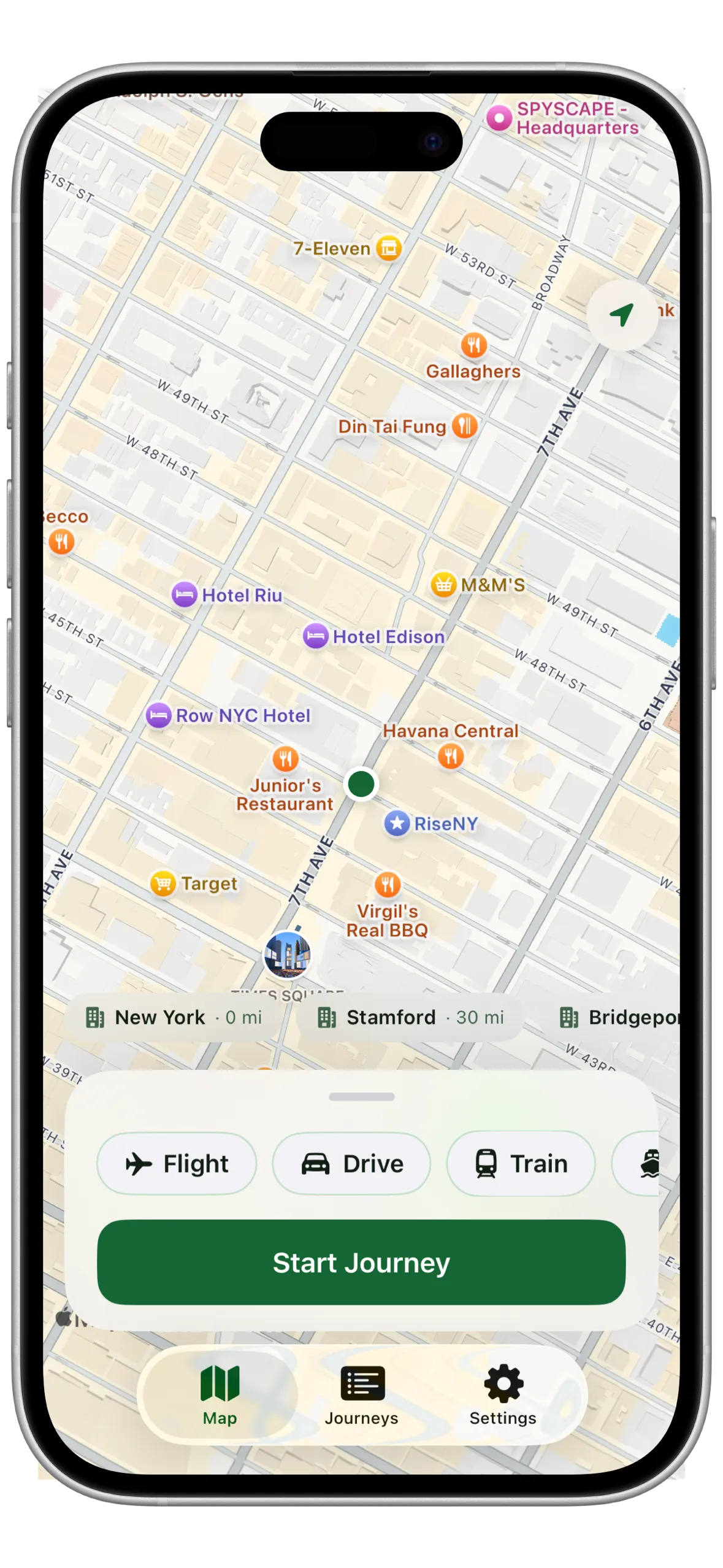
No signal? No problem. Skylog ships with embedded city tiles for major cities. Your map always loads, wherever you are.
Journeys sync silently across all your devices via CloudKit. Start a walk on your iPhone, see it on your iPad. No setup, no manual export.
See your last journey, lifetime distance, and this week's total at a glance. Small, medium, and large sizes. Glanceable without ever opening the app.
Export any journey as a GPX or KML file and open it in Strava, Garmin Connect, Google Earth, AllTrails, or any GPS app. Your data, your way.
Generate a 1080x1080 share card with your route drawn precisely over a real map. Post it to Instagram, iMessage, or save it to Photos in one tap.
Stop for lunch, a photo, or a coffee. Pause recording and resume exactly where you left off. The timer and distance pick up seamlessly, no split journeys.
Choose from walk, run, cycle, drive, flight, train, or boat. Skylog optimises GPS sampling and display for each mode so your log always makes sense.
Location is only active when you're recording. Battery stays healthy.
Your journey list shows a live route thumbnail for each trip alongside the key numbers. Scroll back through months of walks, flights, and commutes in seconds.
Route thumbnails use Apple Maps when connected, offline tiles otherwise.
Tap any journey for the full picture: a zoomable route map, distance, duration, average speed, elevation gain, and a smooth altitude profile chart across the whole trip.
Central Park Loop · 1.98 mi · 1:12:00 · 72 ft gain.
Every journey you record in Skylog can be exported as a GPX or KML file and opened in Strava, Garmin Connect, Google Earth, AllTrails, or any mapping app that accepts standard GPS formats.
GPX for GPS apps. KML for Google Earth and Maps. Both included with Pro.
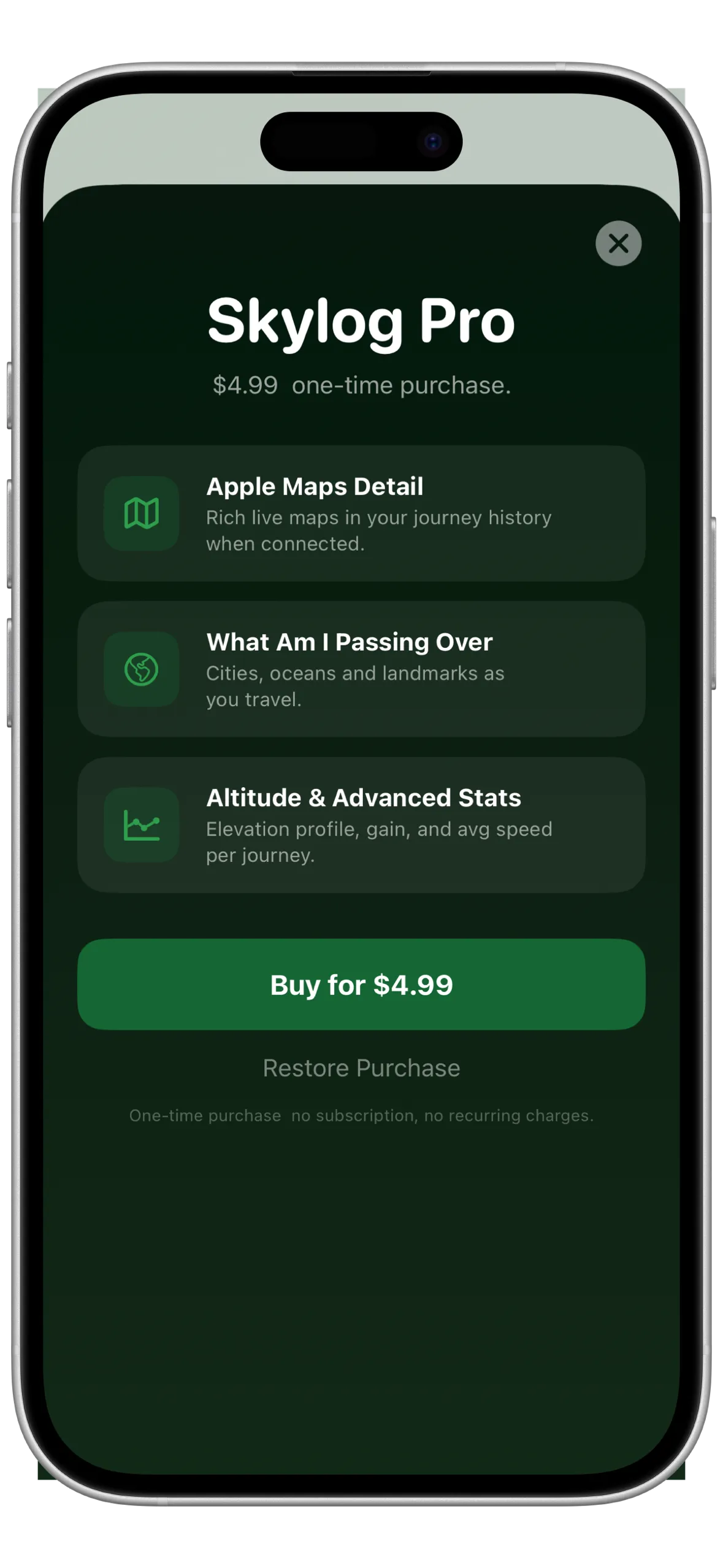
Unlock Apple Maps for rich live thumbnails, the "What Am I Passing Over" places overlay, advanced altitude statistics, and GPX/KML export, all for a single one-time price.
No subscription. No recurring charges. Ever.
Skylog Pro
One-time purchase. No subscription. No ads. No tricks.
Free to download and record. Pro features: $4.99 one-time.
No account. No sign-in. No analytics SDK. No crash reporter. All GPS data lives on your device via SwiftData. iCloud sync uses CloudKit: journeys leave your device only to reach your own other devices, encrypted end-to-end by Apple.
Every walk, ride, flight, and drive. Captured forever.